Heyward Point – Information and Trips Library

Scope:

This page of club tramps and hikes in the West Harbour area groups together trips to Heyward Point,(map) from both Heyward Point Road and Aramoana.

Background Information:

Road distances from Mosgiel carpark.

Part: Tramping Track, Managed by DOC.
Rest: Not during lambing September-November.

Access Permissions maybe required as this trip can venture over a working farm – refer guidelines

TRTC Grading Information – trips incorporating these tracks are generally given a TRTC grading of about 3. This is indicative only, as trips can be allocated a higher or lesser grading depending on the route taken. For more detailed analysis refer to Grading Information.

How To Get There:

(1) Heyward Point – drive SH88 to Port Chalmers. Just before the township turn sharp left onto Borlases Road then right onto Blueskin Road. Follow this road past the Scott Memorial to Purakaunui Road, turn right and continue to Heyward Point Road, again turn right. Parking is available at the end of this road  at the start of the Heyward Point track.

(2) Aramoana – drive via SH88 to Port Chalmers. Proceed through the township to the roundabout and take the left exit onto Aramoana Road. This road passes Careys Bay, Deborah Bay etc and continues to Aramoana township. Take Moana Street which leads to the Mole, for parking.

Links to tramps and hikes in this area:

12/08/2026. Heyward Point from Aramoana. Grade 3. Trampers.  Leaders: . Janice Hodges, Lynley McArley
14/01/2026. Heyward Point Track. Grade 3. Hikers.  Leaders: Sue Beal and Jan Palmer
16/07/2025. Heyward Point from Aramoana. Grade 3.5. Trampers .  Leaders: Karen McInnes, Gail Williams.

Heyward Point, Kaikai Beach, Whareakeake Road. 2024 – 1989 (20 trips with 13 reports).
Aramoana, Heyward Point, Murdering Beach Road. 2005 – 1997 (10 trips, 1 with photo only)
Aramoana – Information and Trips Library

Scope:

This page of club tramps and hikes covers trips in the West Harbour area and groups together trips to Aramoana township including the Mole, Shelley Beach also known as The Spit, Spit Beach (known as Big Beach) and the Salt Marsh board walk. (map)

Background Information:

Road distances from Mosgiel carpark.

TRTC Grading Information – trips incorporating these tracks are generally given a TRTC grading of about 2. This is indicative only, as trips can be allocated a higher or lesser grading depending on the route taken. For more detailed analysis refer to Grading Information.

Definitions:
Aramoana: Pathway of the Sea.
The Spit, known as Shelley Beach.
The Mole: The mole has deprived the Spit of its natural supply of sand.
In 1992 a short board walkway was constructed at this point to try and stop further erosion. Managed by Port of Otago.
Spit Beach. Known as Big Beach. Rock to explore. Great sand slope, towering volcanic cliffs.
Key Rock.
Salt marsh flats. Path. Conservation area. Managed by DOC.

A Brief History of the Mole

How To Get There:

Take SH88 to Port Chalmers. Proceed through the township to the roundabout and take the left exit onto Aramoana Road. This road passes Careys Bay, Deborah Bay etc and continues to Aramoana township. Take Moana Street which leads to the Mole, for parking.

Links to tramps and hikes in this area:

10/09/2025. Aramoana. Grade 2. Hikers. Leaders: Peter Horrell, Jan Palmer.

Aramoana. 2022 – 1989 (17 trips with 8 reports)

Doctors Point, Mopanui, McKessar, Purakaunui, Osborne – Information and Trips Library

Scope:

This page of Club tramps and hikes to  West Harbour and groups together trips to Doctors Point, Mopanui, McKesslar Track, Purakaunui and Osborne townships. (map)

Background Information:

Road distances from Mosgiel carpark.

TRTC Grading Information – trips incorporating these tracks are generally given a TRTC grading of about 3. This is indicative only, as trips can be allocated a higher or lesser grading depending on the route taken. For more detailed analysis refer to Grading Information.

Note: check tides for beach at Doctors Point

The stone-walled ruins on Mckessar Track (General Information)
Mapoutahi Pa (General Information)

A short Purakaunui timeline taken from Te Pari Rehu, The Misty Cliffs by Stan Durry and Dawn Paterson- see Purakanuai and environs trip.

How To Get There:

(1) Doctors Point – take SH1 North to Waitati and at the end of the motorway turn right into Harvey Street. Continue through the township and turn left onto Doctors Point Road. Follow this road which crosses Michies Crossing and descends to the beach where ample parking is available.

(2) Purakanui – take SH88 to Port Chalmers and just prior to the township turn sharp left onto Borlases Road then right onto Bluskin Road. Continue past the Scott Memorial to the intersection and turn right onto  Purakaunui Road. Follow this road and turn left onto Boundary Road which will descend to the domain and parking.

(3) Osborne – as per Purakaunui directions above until the intersection on Purakaunui Road with Purakaunui School Road and  turn left. This road descends to the inlet, turn left and continue to Purakaunui Station Road. Turn left, the road ascends to the railway line and Osborne where parking is available.

Links to tramps and hikes in this area:

08/04/2026. Purakaunui Curcuit. Grade 2. Hikers.  Leaders: Katrina Mc Kenzie and Cathy Ferguson.
18/03/2026. Doctors Point/Mopanui. Grade 4. Trampers. Leaders: Graeme Souter and John Barrett.
27/08/2025. Purakaunui and environs. Grade 3. Hikers.  Leaders: Katrina McKenzie and Jill Thomas
30/07/2025. Purakaunui/ Mopanui. Grade 4. Trampers.  Leaders: Carol and Clare.

Doctors Point, McKessar, Mopanui, Ridgeline. 2024 – 1992 (16 trips with 14 reports)
Orokonui, Mopanui, South Face. 2024 – 1992 (16 trips with 14 reports)
Purakaunui, Mopanui, north face, ret. 2022 – 2010 (6 trips with 6 reports)
Doctors Point area tramps. 2023 – 2008 (25 trips with 20 reports)
Purakaunui. 2021 – 1989 (16 trips with 6 reports)
McKessar Track. 2018 – 2016 (3 trips with 2 reports, 1 photos only)
Potato Point, Purakaunui. 2011 – 2003 (5 trips, 3 with photos only)

Mount Hyde Station – Information and Trips Library

Scope:

This page of club tramps and hikes in the West via SH87 (inland north side SH87) area groups together trips to the Mount Hyde Station (map)

Background Information:

Road distances from Mosgiel carpark.

TRTC Grading Information – trips to Mount Hyde Station are generally given a TRTC grading of 3. This is indicative only, as depending on the route taken, allocation of gradings can differ from this. For more detailed analysis refer to Grading Information.

Access Permissions are required as this trip ventures over a working farm and forestry operations – refer guidelines  Lambing season September – November.

How To Get There:

Take George King Memorial Drive (turn right after crossing the bridge over the Taieri River just out of Outram) and follow the road to Mount Hyde Road (approx 15 km) and turn right. Continue to the end of the gravel road for parking.

Links to tramps and hikes in this area:

Mount Hyde Station. 2023 – 1988 (16 trips, 4 with reports and photos, 1 with report only, 1 with photos only, 10 with no reports or photos)


Bobby’s Head, Goodwood Road, Mount Royal, Puketapu – Information and Trips Library

Scope:

This page of club tramps and hikes covers trips on the North Coast north of Dunedin City, Waitati involving club trips to Goodwood Road, Bobby’s Head, Mount Royal and Puketapu (Palmerston) (map)

Background Information:

Road distances from Mosgiel carpark.

Access Permissions are required as trips to Mount Royal venture over a working farm – refer guidelines

Restrictions: Tavora Reserve (Bobby’s Head) is closed to the public over the penguin breeding season (November to February).
Puketapu Track closed for lambing September – November

TRTC Grading Information – trips incorporating these tracks are generally given a TRTC grading of 3. This is indicative only, as trips can be allocated a higher or lesser grading depending on the route taken. For more detailed analysis refer to Grading Information.

How To Get There:

Bobby’s Head (Tavora Reserve): Drive north on SH1, past Waikouaiti to Goodwood Road (before Palmerston). Turn right onto Goodwood Road and continue to Bobby’s Head Road (about 10 minutes), turn right and proceed to the carpark at the start of the track.

Puketapu Track is located in the township of Palmerston, north of Dunedin on SH1.

Links to tramps and hikes in this area:

22/01/2025. Mt Royal/Bobby’s Head (Tavora Reserve). Grade 3.5. Trampers.  Leaders: Graham Thurlow, Graeme Souter.

Goodwood Road, Bobby’s Head, Puketapu. 2024 – 1987 (7 trips with 5 reports and 1 with photos only)


Hope Hill, Wallace’s Farm – Information and Trips Library

Scope:

This page covers the Club tramps and hikes to Hope Hill located on Wallace’s Farm off SH1  just south of Allanton. (map)

Background Information:

Road distances from Mosgiel carpark.

Access Permissions are required as trips to Hope Hill venture over a working farm – refer guidelines.

Restrictions: lambing August-November

TRTC Grading Information – trips incorporating these tracks are generally given a TRTC grading of 4. This is indicative only, as trips can be allocated a higher or lesser grading depending on the route taken. For more detailed analysis refer to Grading Information.

How To Get There:

Proceed south on SH1 just past Allanton to a farm gate on the left of the highway. Parking is available through the gate on the farm property.

Links to tramps and hikes in this area:

29/01/2025. Hope Hill. Grade 4. Trampers. Leaders: John Gardiner and Martin Hickley.

Wallaces Farm on Hope Hill. 2023 – 1993 (14 trips with 6 reports)


Herbert Forest – Information and Trips Library

Scope:

This page of club tramps and hikes covers trips on the North Coast north of Dunedin City, Waitati involving club trips to Herbert Forest (map).

Background Information:

Road distances from Mosgiel carpark.

TRTC Grading Information – trips incorporating these tracks are generally given a TRTC grading of 3. This is indicative only, as trips can be allocated a higher or lesser grading depending on the route taken. For more detailed analysis refer to Grading Information.

How To Get There:

Take SH1 north towards Herbert township. Turn left off SH1 just before the hill over the railway line just past Waianakarua onto Breakneck Road. Take an immediate right on Breakneck Road and continue past the camping ground to Reid Road. Turn left for parking and the Herbert Forest track.

Links to tramps and hikes in this area:

Herbert Forest. 2022 – 2019 (2 trips with 2 reports)

Karitane, Split Rock, Maori Peak, Seacliff, Warrington – Information and Trips Library

Scope:

This page of club tramps and hikes covers trips on the North Coast north of Waitati and groups trips to Karitane (Huriawa Pa site), Split Rock (including Maori Peak), Seacliff and Warrington. (map)

Background Information:

Road distances from Mosgiel carpark.

Access Permissions are required as trips to Split Rock and Maori Peak ventures over a working farm – refer guidelines. 

Restrictions – calving time is September for Split Rock, Maori Peak.

TRTC Grading Information – trips incorporating these tracks are generally given a TRTC grading of 2-3. This is indicative only, as trips can be allocated a higher or lesser grading depending on the route taken. For more detailed analysis refer to Grading Information.

History of Huriawa Pa, Sir Truby King or early Methodist missionary James Watkin, it’s all just a click away here.
Background Notes on Maori Peak
Seacliff Hospital Fire (Backgound information)
Brinns Point to Seacliff (General Information)
Seacliff Dam Historical Track (General Information)
Seacliff Hospital (General Information)

How To Get There:

(1) Warrington – take SH1 North around Blueskin Bay to Evansdale and turn right onto Coast Road and follow road to Warrington. Take right turn down Bank Road and left into Bay Road that ends at the beach domain.

(2) Seacliff (Maori Point, Split Rock) – take SH1 North as above and continue on Coast Road past Warrington and turn left onto Russell Road to the Truby King Reserve.

(3) Karitane – as above, follow Coast Road past Warrington and Seacliff directly to Karitane, or continue on SH1 to Hawksbury (formerly Cherry Farm) and turn sharp right onto Coast Road, follow to Karitane township. Park at the Karitane Domain.

Links to tramps and hikes in this area:

16/10/2024. Warrington, Seacliff. Grade 2. Hikers.  Leaders: Maria MacNee, Julie MacKenzie..

Karitane beach to Huriawa Pa, Beach walk. 2022-1989 (24 trips with 9 reports)
Maori Peak, Split Rock (Trampers). 2024 – 1989 (18 trips with 8 reports)
Seacliff, Split Rock (Hikers). 2021 – 1988 (14 trips with 3 reports)
Warrington. 2024 – 1993 (11 trips with 7 reports)
Warrington, Omimi, Slaughterhouse. 2012 – 1991 (9 trips with 4 reports)
Warrington, Porteous Hill, Hammond Hill, Guilds Hill. (2004 – 1996 (3 trips with 1 report – photos only)

Waikouaiti, Hawksbury Lagoon, Matanaka – Information and Trips Library

Scope:

This page of club tramps and hikes covers trips on the North Coast north of Dunedin City, Waitati and groups trips to Waikaouati, the Hawksbury Lagoon, Matanaka Homestead. (map)

Background Information:

Road distances from Mosgiel carpark.

TRTC Grading Information – trips incorporating these tracks are generally given a TRTC grading of about 2. This is indicative only, as trips can be allocated a higher or lesser grading depending on the route taken. For more detailed analysis refer to Grading Information.

How To Get There:

Take SH1 north to Waikouati township. Turn right onto Beach Street and follow the road to the beach where there is parking. Conversely continue on the road (to the left) to the recreation reserve where again there is parking and toilets available.

Links to tramps and hikes in this area:

07/05/2025. Waikouaiti – Matakana. Grade 2.5. Combined.  Leaders: Carol Thurlow, Jill Thomas and Clare Banks (with much help from Graham Thurlow)
09/04/2025 Old Country Track, Waikouaiti Grade 2  Hikers or Combined.  Leaders: Jan Butcher, Shirley and Noel McRandle.

Waikouaiti: Matanaka, Beach Walk. 2024 – 2017 (15 trips with 8 reports)
Garden Bush. Trig 1080: HH (hill), Waikouaiti. 2003 (1 trip photos only)

Careys Creek, Rongami, Honeycomb, Evansdale Glen, Black Gully Dam – Information and Trips Library

Scope:

This page of club tramps and hikes covers trips on the North Coast, north of Dunedin City, Waitati and groups trips to Careys Creek, Rongami and Honeycomb Tracks, Evansdale Glen and Black Gully Dam. (map)

Background Information:

Road distances from Mosgiel carpark.

TRTC Grading Information – trips incorporating these tracks are generally given a TRTC grading of 4. This is indicative only, as trips can be allocated a higher or lesser grading depending on the route taken. For more detailed analysis refer to Grading Information.

Information on the Seacliff Dam, historical creek track and pipeline.

How To Get There:

Careys Creek is reached via SH1 at Evansdale Glen located just as the road begins to climb over the Kilmog. A sign on the left of the road indicates the route down to Evansdale Glen where there is limited parking available prior to driving through the stream to the picnic area.

Links to tramps and hikes in this area:

28/05/2025. Careys Creek / Black Gully. Grade 4.5. Trampers.  Leaders: Ross and Wyn Davie.

Evansdale , Careys Creek, Honeycomb, Rongomai. 2024 – 2005 (17 trips with 9 reports).
Careys Creek from Evansdale. 2022 – 1989 (13 trips with 4 reports, 2 with photos only).
Black Gully Dam/Careys Creek. 2019 (1 trip with report).
Careys Creek track, Black Gully Dam to Evansdale. 2017 – 1994 (8 trips with 6 reports).

Mt Watkin – Information and Trips Library

Scope:

This page of club tramps and hikes covers trips on the North Coast north of Dunedin City, Waitati involving club trips to Mount Watkin. (map)

Background Information:

Road distances from Mosgiel carpark.

TRTC Grading Information – trips incorporating these tracks are generally given a TRTC grading of 4. This is indicative only, as trips can be allocated a higher or lesser grading depending on the route taken. For more detailed analysis refer to Grading Information.

How To Get There:

Take SH1 North and turn left onto McGrath Road just before the Hawkesbury (old Cherry Farm site). Continue on this road to the intersection of Ramrock and Mount Watkin Roads and turn left onto Mount Watkin Road. Continue onto an area (approx 5kms) to a limited parking area below Mount Watkin itself.

Links to tramps and hikes in this area:

Mount Watkin/Hikaroroa Open Day. 2023 – 2010 (4 trips with 4 reports)

Chrystalls Beach, Toko Mouth, Cooks Head – Information and Trips Library

Scope:

This page of club tramps and hikes covers trips on the South Coast and includes trips to Chrystalls Beach, Toko Mouth and Cooks Head. (map)

Background Information:

Road distances from Mosgiel carpark.

TRTC Grading Information – trips incorporating these tracks are generally given a TRTC grading of  2. This is indicative only, as trips can be allocated a higher or lesser grading depending on the route taken. For more detailed analysis refer to Grading Information.

How To Get There:

Take SH1 south and turn left onto Forsyth Road (just before Milton). At the end of this road turn right onto Back Raod then left onto Glenledi Road. Follow this road some distance to reach Chrystalls Beach.

Links to tramps and hikes in this area:

Chrystalls Beach, Toko Mouth. 2023 – 1989 (22 trips with 10 reports)

Nichols Farm (was Michelles Farm) – Information and Trips Library

Scope:

This page of club tramps and hikes covers trips West via SH87 which includes trips to Nichols Farm – north side of the Taieri River. (map)

Background Information:

Road distances from Mosgiel carpark.

Access Permissions are required as trips to Nichols Farm ventures over a working farm – refer guidelines

Restrictions: lambing August-November

TRTC Grading Information – trips incorporating these tracks are generally given a TRTC grading of 3. This is indicative only, as trips can be allocated a higher or lesser grading depending on the route taken. For more detailed analysis refer to Grading Information.

How To Get There:

Drive to the Outram Bridge via  Outram Mosgiel Road. Turn right before going across the bridge and park down underneath the bridge. Limited parking is available.

Links to tramps and hikes in this area:

20/08/2025. Nichol’s Farm (Michelle’s Farm). Grade 4. Trampers.  Leaders: Gail Williams, Lynley McArley.
23/7/2025. Nichols Farm. Grade 3.5. Hikers.  Leaders: Wendy Langley and Carol-Anne Buchanan.

Nichols Farm (formerly Michelles Farm), North Side Taieri River, Outram. 2023 – 1989 (15 trips with 6 reports)

Woodside Glen, Maungatuas – Information and Trips Library

Scope:

This page of club tramps and hikes covers trips West via SH87 which includes trips to the Woodside Glen and Maungatuas. (maps)

Background Information:

Road distances from Mosgiel carpark.

TRTC Grading Information – trips incorporating these tracks are generally given a TRTC grading of 3. This is indicative only, as trips can be allocated a higher or lesser grading depending on the route taken. For more detailed analysis refer to Grading Information.

How To Get There:

Take Outram Mosgiel Road to Outram, proceed through the township and turn right. Turn left off the highway (SH87 – Lee  Stream – Outram Road) just before it starts climbing the hill onto Woodside Road then right onto Ravensburn Street (5-10 minutes from turn off) and then left onto Mountain Road which leads to the Woodside Glen and the picnic area.

Links to tramps and hikes in this area:

Woodside Glen, plus to top of Maungatuas. 2024 – 1992 (18 trips with 11 reports)

Nicols Creek, Swampy, Pineapple Track, Moon Track, Booth Road

(David Nicol was an early settler and dairy farmer. He reputedly bought land here in the hope that the railway line would be routed north through Leith Valley.)

Click here for Antony Hamel’s YouTube video showing his exploration of the 5 falls of Nicols Creek
Neighbours at War Click here for background and photos to the Finnerty Family and their house site on the Moon Track by Nicols Creek.
Click Swampy ridge track for background information.
Click Pineapple Track for background information.
Click Pineapple and Flagstaff walk for background information.
No. 17 on old hardcopy list of 113 club tramps. “Nicols Creek. D McCabe. Year Round”
Nicols Creek circuit Maintained by Green Hut Track Group.
DCC land.
Booth Road 16.1 km from car park.
Nicols Creek – Information and Trips Library


27. 30/08/2023. Trampers. Pineapple Track-Nicols Creek Grade 3.5-4 Leaders: Sarah and John
An Interview with Pineapple Track/Nicols Creek Tramp Leader Sarah by Tail End Charlie, John

Hi Sarah. You were a late incumbent to the leadership of this tramp?

– Yes, Ross was originally down to lead it, but back problems meant he asked me to lead it instead. (Best wishes for a speedy recovery Ross.)

Did you do a recce the Saturday prior?

– That’s right, Craig went mountain biking, and I went exploring on foot, in the area, to finalize the tramp format.

Were the group lucky with the weather on the day?

-The weather was brilliant. Sunshine, little or no wind and temperatures towards the mid-teens. The tracks were reasonably dry.

And did we have a good attendance?

– There were 18 of us – arriving at Tanner Rd/Fulton Rd corner in 7 cars.

What was the tramp route?

-We started on the Pineapple Track, walking up to the Pump House for morning tea.

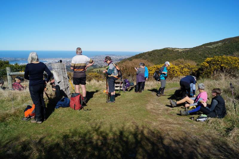
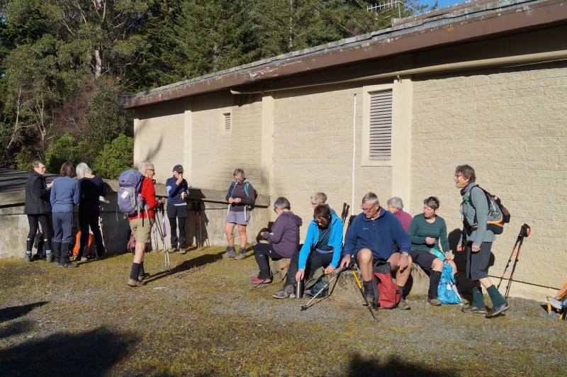
Getting ready for morning tea in the sun Caption and photo John

Then we carried on up the Pineapple Track, turning off at McGouns Track onto the Old Pineapple Track. This led us to the “new” Pineapple Track by Pineapple Point.

crossing Nicol’s stream Caption and photo Pam

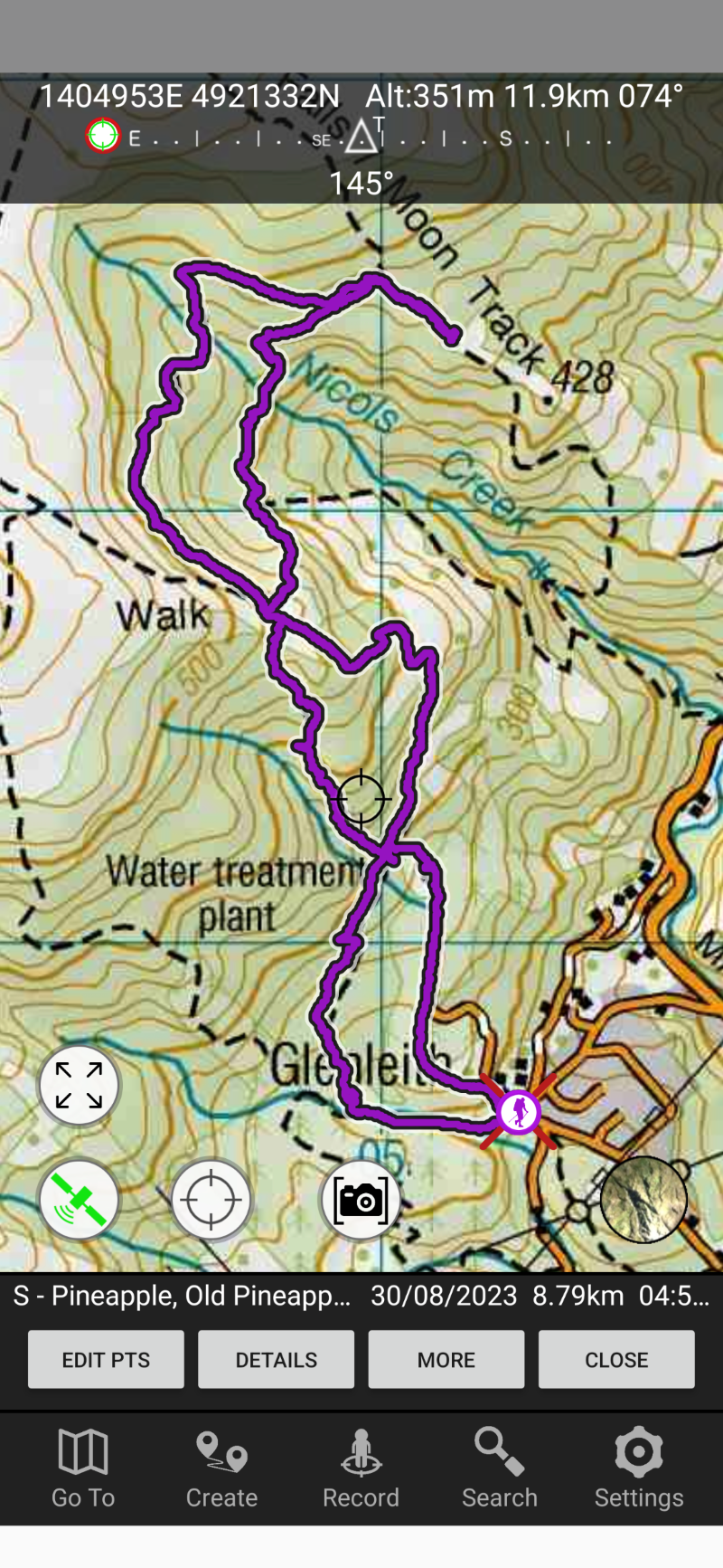
From here we followed the lower track, traversing Nicols Creek before arriving at the Mountain Bike picnic table at 11.55am for lunch.

Lunch with a view worth taking in Caption and photo John
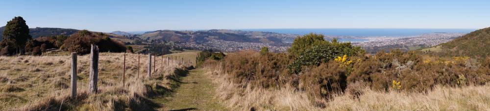
Panorama - View from lunch spot. Caption and photo John
Panorama – View from lunch spot. Caption and photo John

After lunch it was onto the upper track, traversing Nicols Creek.

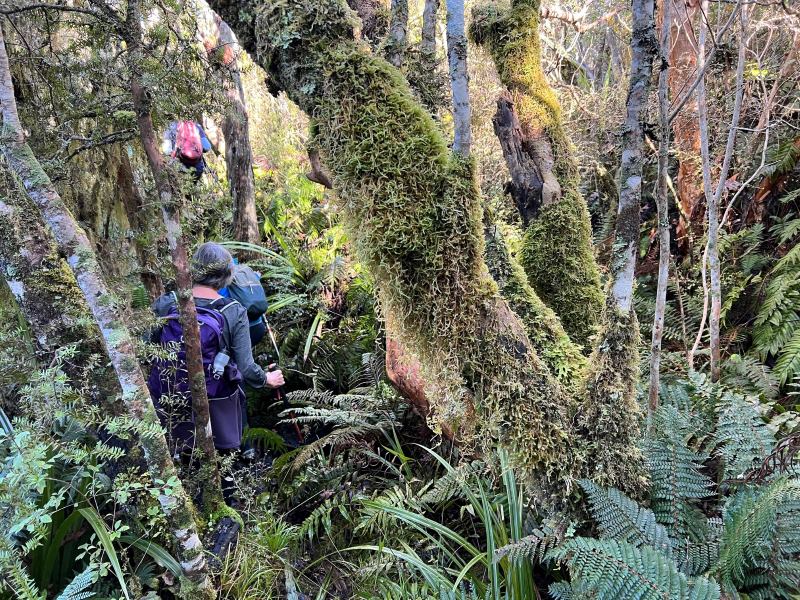
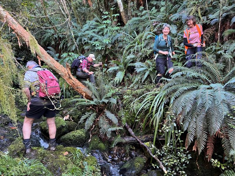
somewhere in the bush! Caption and photo Pam

Then onto the “new” Pineapple Track, and back to the cars via McGouns Track.

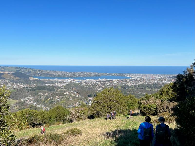
Heading down the pineapple track Caption and photo Pam

Wahl!! I think you lost me somewhere there! Did the tramp take long Sarah?

– The recce only took me 3 hours. On the day the tramp took us much longer at 5 hours. Some technical terrain reduced the tramp down to a crawl pace in parts.

Did you manage to squeeze in coffee afterwards?

–        Only just. We were back at the cars by 3.00pm, then headed straight to the Fire Station Cafe’ in Roslyn.

How would you describe the shape of the tramp?

– Roughly a double figure 8.

Sounds lucky, I think? Thanks for the interview, Sarah.

Screenshot Sarah
Screenshot Sarah

Continue reading “Nicols Creek, Swampy, Pineapple Track, Moon Track, Booth Road”