Green Hut, Pulpit Rock

Location: 43 km from car park. Click Silver Peaks Forest for background information. No. 21 on old hardcopy list of 113 club tramps. “Green Hut & Pulpit Rock return or via Possum Hut. Year Round. Long.”

23. 1/10/2023. Combined. Green Hut Site and Pulpit Rock. Tramp Grade 4, Hike Grade 2. 43km. Leaders: Neil Hodgkin/Chris Bezett, Dave Roberts/Jay Devlin.

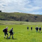
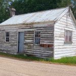
image (2) Helen square RES100x100Hike to Green Hut (which is now two seats as the hut was deconstructed in 1988 because of ongoing vandalism).
On a foggy morning 18 keen hikers regathered at the On the Spot garage at Waitati where we turned left up a dusty road to the beginning Continue reading “Green Hut, Pulpit Rock”

Bull Ring, Flagstaff Walkway, Ben Rudd, Pineapple Track – Information and Trips Library

Scope:

This page of club tramps and hikes in the Dunedin Central City area groups together trips from the Bull Ring (Flagstaff / Whare Flat Road) and incorporates the Flagstaff Walkway, Pineapple Track and Ben Rudd shelter. (map)

Background Information:

Road distances from Mosgiel carpark.
Location: 13.3 km from car-park.

TRTC Grading Information – trips incorporating these tracks are generally given a TRTC grading of about 3. This is indicative only, as trips can be allocated a higher or lesser grading depending on the route taken. For more detailed analysis refer to Grading Information.

Dunedin’s Hills’ History for background information.
Pineapple Track for background information.
Pineapple and Flagstaff walk for background information.
Flagstaff Name for its origin.
Ben Rudd Article for background information.

How To Get There:

Access to the Bull Ring (and the Pineapple Track) on Flagstaff is off the Flagstaff-Whare Flat Road. This can be accessed off Three Mile Hill Road by turning left at the top of Three Mile Hill and continuing approx. 5 minutes to the Bull Ring carpark.

Links to tramps and hikes in this area:

10/06/2026. Flagstaff. Grade 3. Hikers.  Leaders: Phil Keene and Barbara Shackell.
23/10/2024. Flagstaff, Bull Ring.  Grade 2.5. Hikers.  Leaders: Theresa White, Julie MacKenzie.

Bull Ring, Flagstaff Walkway/ Pineapple Track. 2018 – 2008 (8 trips, 3 with reports and photos, 2 with photos only, 3 with no reports or photos)
Bull Ring, Ben Rudd. 2024 – 1995 (13 trips, 3 with reports and photos, 10 with no reports)


Sullivans Dam, Cloud Forest, 3 Peaks – Information and Trips Library

Scope:

This page of club tramps and hikes in the Dunedin Central City area groups together trips  to Mt Cargill via Cowan Road, Sullivans Dam, Cloud Forest Track, 3 Peaks Track, Escarpment Track. (map)

Background Information:

Road distances from Mosgiel carpark.

Map: Sullivans Dam, Cloud Forest, Telegraph (Old Bridal) track to Pigeon Flat, Escarpment Track, Cowan Rd, Short Cut to Fox Rd, down to Sullivans Dam – drawn 2002. – click on Sullivans Dam, Cloud Forests, Escarpment, Cowan round trip link below.

TRTC Grading Information – trips incorporating these tracks are generally given a TRTC grading of about 3. This is indicative only, as trips can be allocated a higher or lesser grading depending on the route taken. For more detailed analysis refer to Grading Information.

How To Get There:

(1) Sullivans Dam – drive north along the one way street system to David Street and turn right. Follow the road through the traffic lights to Malvern Street (past Woodhaugh Garden). Continue up Malvern St to Morrisons Road (where the seal ends) and cross the overbridge (over SH1) to Sullivans Dam.

(2) 3 Peaks Track – this is accessed off Cowan Road. Take the one way street system north and turn right just before the motorway onto Pine Hill Road. Continue on this road to the very end and turn right onto Cowan Road.

Links to tramps and hikes in this area:

23/09/2026. Cloud Forest / Sullivans Dam. Grade 3. Trampers.  Leaders: John Gardiner and Gwenda Farquharson.
12/11/2025. Three Peaks, Escarpment, Cloud Forest Loop. Grade 3.5. Trampers.  Leaders: Sarah McCormack and Karen McInnis.

Pine Hill, Mount Cargill round trip. 2023 -1991 (4 trips, 1 with report and photos – 23/9/2023)
Sullivans Dam, Cloud Forests, Escarpment, Cowan round trip. 2022-2005 (10 trips, 5 with reports and photos, 2 with photos only, 5 with no report or photos)
Sullivans Dam. 2009 – 1998 (7 trips – no reports or photos)
Leith Saddle, Sullivans Dam, Bridle Track, Pigeon Flat. 2006 – 1999 (4 trips – no reports or photos)
 

Shannons Farm Walk

Distance from PJP car park 48km.

Middlemarch Area – Information and Trips Library


3. 25/10/2023. Trampers.  Cairn Valley/Shannon, Grade 3, 48km. Leaders: Heather Kirk, Diane Paterson.

Walking through lush grassLovely sunshine greeted 30 keen trampers for a good day’s walk on Cairnvalley Farm Shannon. Strath Taieri offers something different in scenery with tussock hills, huge rock formations and at this time of the year fresh green vistas of paddocks and Continue reading “Shannons Farm Walk”

Outram – Allanton Flood Bank

Outram 10 km /  Henley 21 km – from car park.

Outram, Allanton, Floodbanks, Lee Stream, Traquair, Whare Creek – Information and Trips Library


4. 25/10/2023. Hikers. Outram Loop. Grade 1.5, 11km, Leaders: Sue Nichol, Kathryn Fagg.

image (1) Square RES150x150Outram turned on another scorcher for 16 hikers. We started at the West Taieri Rugby Club and walked around Kings Court and Anzac Court subdivisions where the gardens were in full bloom. Continue reading “Outram – Allanton Flood Bank”

Greengage Track – Information and Trips Library

Scope:

This page of club tramps and hikes in the Silver Peaks area groups together those trips to the Greengage Track  (map) which incorporates Raingauge Spur, Swampy Ridge, Rollinsons and Green Ridge Tracks.

Background Information:

Road distances from Mosgiel carpark.

TRTC Grading Information – trips incorporating these tracks are generally given a TRTC grading of 5. This is indicative only, as trips can be allocated a higher or lesser grading depending on the route taken. For more detailed analysis refer to Grading Information.

The Greengage Track runs between Raingauge Spur and the Green Ridge Track. There is a number of ways to access this track – the following provides 3 options.

How To Get There:

Option 1 – via Raingauge Spur which is via Rollinsons Road and  will require a key to the gate approx. 2 km’s from the “Elbow” where the Raingauge track starts. A key is currently held by the club President.

Option 2 – via the Swampy Ridge Track. Access to the summit of Swampy is via Rollisons Road (option 1) with the track commencing from the Swampy Summit. This route joins the Green Ridge which forks with Greengage.

Option 3 – via Waitati. Turn left onto Double Hill Road which joins Semple Road to the starting point of he Green Ridge Track.

Links to tramps and hikes in this area:

30/10/2024. Greengage Track. Trampers.  Leaders: Graeme Souter and Graham Thurlow.

Greengage Track. 2019-2014 (3 trips with reports and photos)


St Clair Beach Walks

17. 11/10/2023. Hikers. St Clair, St Kilda, Ocean Grove. Grade 2, $5, 17km, Leaders: Bruce Spittle/Alex Griffin
IMG20231011111808 RES100x100Nineteen hikers left Marlow Park in sunny conditions at about 0930 after singing happy birthday to Liz Griffin and walked over the Kettle Park Sports field and up a track to the Barnes Lookout.

Continue reading “St Clair Beach Walks”

Trotters Gorge – Information and Trips Library

Scope:

This page of club tramps and hikes covers trips on the North Coast north of Dunedin City, Waitati involving club trips to Trotter Gorge. (map)

Background Information:

Road distances from Mosgiel carpark.

TRTC Grading Information – trips incorporating these tracks are generally given a TRTC grading of about 3. This is indicative only, as trips can be allocated a higher or lesser grading depending on the route taken. For more detailed analysis refer to Grading Information.

How To Get There:

Take SH1 North and at the end of the Katiki Straight (before Moeraki) turn left onto Horse Range Road. Follow this road to Trotters Gorge Road and turn right onto Trotters Gorge Road continue on to the DOC Scenic Reserve for parking and toilets.

Links to tramps and hikes in this area:

09/04/2025. Trotters Gorge. Grade 3. Trampers.  Leaders: Neil Hodgkin and Sarah McCormack.

Bus Trip: Trotters Gorge. 2022 – 2003 (4 trips, 2 with reports and photos, 1 with phots only, 1 with no report or photos)
Horse Range, Trotters Gorge. 2004 (1 trip, photos only)


Harwood – Information and Trips Library

Scope:

This page of club tramps and hikes covers trips to the Otago Peninsula and involves trips to Harwood. (map)

Background Information:

Road distances from Mosgiel carpark.

TRTC Grading Information – trips incorporating these tracks are generally given a TRTC grading of about 2. This is indicative only, as trips can be allocated a higher or lesser grading depending on the route taken. For more detailed analysis refer to Grading Information.

How To Get There:

Drive along Portsmouth Drive and turn left over the causeway and follow Portobello Road through Portobello township (approx. 19 kms.)  and onto Harington Point Road. Take a left onto Tidewater Drive (where Harington Point Road takes a sharp right) to Harwood township

Links to tramps and hikes in this area:

29/01/2025. Harwood Area. Grade 2. Hikers.  Leaders: Raewyn Keene and Helen Morris.

Harwood – End of year picnic. 2017 – 1998 (6 trips, 1 with reports and photos, 3 with photos only, 2 with no report or photos)


Chrystalls Beach, Toko Mouth

No. 47 on old hardcopy list of 113 club tramps. “Toko Beach. M Young”; also No. 65 on old hardcopy list of 113 club tramps. “Chrystalls Beach Farm”. Location: 59 km from the car park. Best in Summer. The stock winter over.
Directions: On SH1, before Milton, at Helensbrook intersection, left onto Forsyth Road, right onto Back Road, left onto Glenledi Road.

Chrystalls Beach, Toko Mouth, Cooks Head – Information and Trips Library


22. 11/10/2023. Trampers. Crystalls Beach. Grade 2.5, $15, 59km, Leaders: Dave Roberts, Jill Reid
IMG_7384 100x100A fine overcast morning greeted us at Peter Johnstone Park with 19 trampers in 5 cars beginning our tramp at 10am. Continue reading “Chrystalls Beach, Toko Mouth”

Akatore Area (inc. Coutts Farm / Gully, Taieri Mouth) – Information and Trips Library

Scope:

This page of club tramps and hikes in the South Coast area groups together trips to the Akatore Area including Coutts Farm / Gully, Sawmill Road and Taieri Mouth. (map)

Background Information:

Road distances from Mosgiel carpark.

Access Permissions are required for trips to Akatore and Coutts Farms – refer guidelines

TRTC Grading Information – trips incorporating these tracks are generally given a TRTC grading of 3. This is indicative only, as trips can be allocated a higher or lesser grading depending on the route taken. For more detailed analysis refer to Grading Information.

How To Get There:

To reach Akatore Creek take the Taieri Mouth Road from Brighton, across the bridge at Taieri Mouth. Continue on Moturata Road and onto Akatore Road to Akatore Creek carpark on the left, just before crossing Akatore Creek bridge.

Links to tramps and hikes in this area:

16 /7/2025. Taieri Mouth. Grade 2.5. Hikers.  Leaders: Alex Griffin, Adrienne Ensor.
09/07/2025. Coutts Farm. Grade 3. Hikers.  Leaders: Bruce Wright and Peter Beal.
15/01/2025. Akatore Creek to Taieri Mouth. Grade 3. Trampers.  Leaders: Spen Walker and Jane Bruce.

Coutts Gully / Farm, Sawmill Road. 2024 – 1988 (23 trips, 10 with reports and photos, 1 with photos only, 1 with report only, 11 with not report or photos).
Akatore Farm Walk or Beach Walk. 2019 – 1991 (15 trips, 8 with reports and photos, 2 with photos only, 5 with no report or photos)
Akatore Forest. 2016 – 1991 (8 trips, 4 with reports and photos, 4 with no reports or photos)


Takitakitoa Wetlands – Information and Trips Library

Scope:

This page of club tramps and hikes in the South Coast area groups together trips to the Takitakitoa Wetlands Reserve. (map)

Background Information:

Road distances from Mosgiel carpark.

TRTC Grading Information – trips incorporating these tracks are generally given a TRTC grading of  2. This is indicative only, as trips can be allocated a higher or lesser grading depending on the route taken. For more detailed analysis refer to Grading Information.

https://www.fishandgame.org.nz/game-bird-hunting-in-new-zealand/where-to-hunt/regional-info/otago/takitakitoa-wetland/

https://www.southroads.co.nz/projects/takitakitoa-wetland-restoration-project

How To Get There:

The Takitakitoa Wetlands is located about 40 minutes drive south of Dunedin and is at the end of Takitakitoa Road off Otokia-Kuri Bush Road. Take SH1 south and turn off at the Henley turn off just before the bridge that crosses the Taieri River. Turn right onto Otokia-Kuri Bush Road West which will intersect with Otakia-Kuri Bush Raod.

Links to tramps and hikes in this area:

11/12/2024. Takitakitoa, Wetland, Waihola Hall. Grade 2. Combined hike and Christmas Lunch.  Leaders: Jan Butcher, Wendy Langley, John Gardiner, Graeme Souter.

7/4/2021. Takitakitoa Wetland/Lester Harveys 90th Birthday. All. Leaders. Raewyn, Phil and Jill D


Powder Ridge – Information and Trips Library

Scope:

This page of club tramps and hikes in the Whare Flat area  groups together trips to Powder Ridge (map)

Background Information:

Road distances from Mosgiel carpark.

TRTC Grading Information – trips incorporating these tracks are generally given a TRTC grading of 5. This is indicative only, as trips can be allocated a higher or lesser grading depending on the route taken. For more detailed analysis refer to Grading Information.

Silver Peaks Forest for background information on the nearby area. DCC land.
Powder Ridge Maintained by Green Hut Track Group.

How To Get There:

Powder Ridge track runs between Racemans and Long Ridge Tracks. It is best accessed from Racemans Track approximately 30 -40 minutes from the Whare Flat carpark along the Silverstream Valley Road off Dukes Road North (just before Three Mile Hill)

Links to tramps and hikes in this area:

12/02/2025. Powder Ridge to Long Ridge (return). Grade 5. Leaders: Pam Cocks, Esther Willis.

Powder Ridge tramps. 2021 – 1991 (13 trips, 6 with reports and photos, 1 with photos only, 6 with no reports or photos)


Craiglowan Falls – Information and Trips Library

Scope:

This page of club tramps and hikes in the area of Whare Flat groups together trips to the Craiglowan Falls (map)

Background Information:

Road distances from Mosgiel carpark.

TRTC Grading Information – trips incorporating these tracks are generally given a TRTC grading of 4. This is indicative only, as trips can be allocated a higher or lesser grading depending on the route taken. For more detailed analysis refer to Grading Information.

How To Get There:

From PJP take Factory Road to Dukes Road and turn left onto the Silverstream Valley Road. follow this road to the right turn onto Flagstaff-Whare Flat Road. Proceed past Rollinsons Road to the track which is located on the right at Sanitorium Road.

Links to tramps and hikes in this area: 

22/04/2026. Craiglowan Falls. Grade 4. Trampers. Leaders: Katrina McKenzie and Julie McKenzie
21/05/2025. Craiglowan Falls. Grade 4. Trampers.  Leaders: Katrina McKenzie & Julie MacKenzie.

Craiglowan Falls. 2018 – 1997 (9 trips, 4 with reports and photos, 1 with photos only, 4 with no reports or photos)

Orokanui Lagoon and Ecosanctuary, Waitati – Information and Trips Library

Scope:

This page of club tramps and hikes to the West Harbour area groups together trips to the Orokanui Lagoon, Waititi area and the Ecosanctuary. (map)

Background Information:

Road distances from Mosgiel carpark.

TRTC Grading Information – trips incorporating these tracks are generally given a TRTC grading of about 3. This is indicative only, as trips can be allocated a higher or lesser grading depending on the route taken. For more detailed analysis refer to Grading Information.

How To Get There:

(1) via Waitati – take the Northern Motorway to Waitati and turn right onto Harvey Street into the township. Drive through the township to Orokonui Road and continue to the sanctuary and carparks.

(2) via Port Chalmers – take SH88 to Port Chalmers and turn left onto Borlases Road just before entering Port Chalmers. Continue up this road  and take a sharp left onto Blueskin Road which will take you to the sanctuary.

Links to tramps and hikes in this area:

01/04/2026. Coastal Connection/ Orokanui Lagoon Walk. Grade 3.  Combined.  Leaders: Pam Cocks; Tail-end Charlies: Val Cayford, Julie McKenzie, Adrienne Ensor
22/10/2025. Orokonui Lagoon/Waitati Grade 2. Hikers.  Leaders: Phil and Raewyn Keene.
20/11/2024. Orokonui / Wrights Road.  Grade 3. Hikers.  Leaders: Jay Devlin and Pam Clough.

Orokonui Ecosanctuary. 2012 – 1996 (9 trips, 1 with reports and photos, 1 with photos only, 7 with no reports or photos)